Aliceville Lake Fishing Spot
- County: Pickens
- Acreage: 8300
- Public Fishing: Yes
- Elevation: 136'
- Website: http://www.outdooralabama.com/
- Last Modified By: vinny60 on 10/10/09 01:23 PM
- Ask about Aliceville Lake in our Fishing Forums
Photos
Fish Species
Comments
-
Aliceville has an excellent tailwater fishery for catfish, crappie, bass, and drum. A fishing pier located on the west bank at Aliceville Reservoir immediately below the dam provides a platform for anglers to fish the tailwaters of Aliceville. Popular top water baits on this lake include willow-leaf spinning lures, Jitterbugs, Torpedo and stick baits. However, many anglers prefer the traditional plastic worm or lizards to catch largemouth bass along submerged weed beds, or along the border of emergent lilly pads or American lotus. Bluegill and redear sunfish are very abundant, and are often found in backwater coves or sloughs near underwater structure. Crickets and small spinner baits are effective for catching these species of sunfish.
Aliceville Lake Description
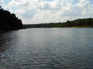
Aliceville Reservoir, sometimes called Pickensville Lake by local anglers, is an 8,300-acre reservoir located approximately 12 miles northwest of the City of Aliceville in Pickens County. The reservoir is formed by the Tom Bevill Lock and Dam, which is located one mile southwest of Pickensville, just off Alabama State Highway 14. This reservoir is popular with anglers from both Alabama and Mississippi since portions of the impoundment are located in both states. There are modern campgrounds, many day-use facilities for picnicking or water sports, as well as primitive camping areas. Two public access areas with bank and boat access and one user fee boating access area service Aliceville Reservoir.
Aliceville Lake is a reservoir in northwest Alabama on the Tennessee-Tombigbee Waterway. Close to Aliceville, it is impounded by the Tom Bevill Lock and Dam.